So the culmination of this extensive
South Philly bike ride is the lovely FDR Park.
The park was designed by the successors of the famed landscape
architect, Fredrick Law Olmsted; the Olmsted bothers (the son and step son of
Big Daddy Olmsted). Created as a recreation and fairground area for the 1926 National
Sesquicentennial, the same fair that brought the giant Liberty Bell to South
Broad Street, the park has many defining features of the Olmsted clan:
- A sinuous drive around the park
- Many meticulously placed trees that are appropriate in scale of the drive and the park
- A large amount of water features, namely lakes and lagoons that have a plethora of stone bridge crossings
Additionally there is an
oversized beaux arts gazebo and a boathouse still standing, remnants of the fair. However, along with the structures, much of
the park’s landscaping and trails they show signs of years of neglect.


The southern edge of the park
has been co-opted by I-95. While many
times the interstate system has cut through urban neighborhoods and desecrated
waterfronts, I’d like to argue in this case that I-95 adds a certain element to
this park. Yes the interstate isn’t a
glowing example of architecture that the rest of the park has quasi-maintained.
As a planner and urban enthusiast it’d be great to not have large freeways cutting
through masterfully-planned, serene park settings. However the space underneath
for the most part is pretty unimpeded as from east to west the freeway begins
its ascent to bridge the Schuylkill and the industrial wasteland below. It provides a rare example of a large civil
engineering project that has not destroyed a neighborhood or where people are
forced to live near (i.e. I-676). While the
underside of the bridge is not magnificent and it doesn’t have the same ornamentation
as say the Ben Franklin Bridge or even the sleekness of the Walt Whitman Bridge,
it is a testament to current standards for such large scale projects.
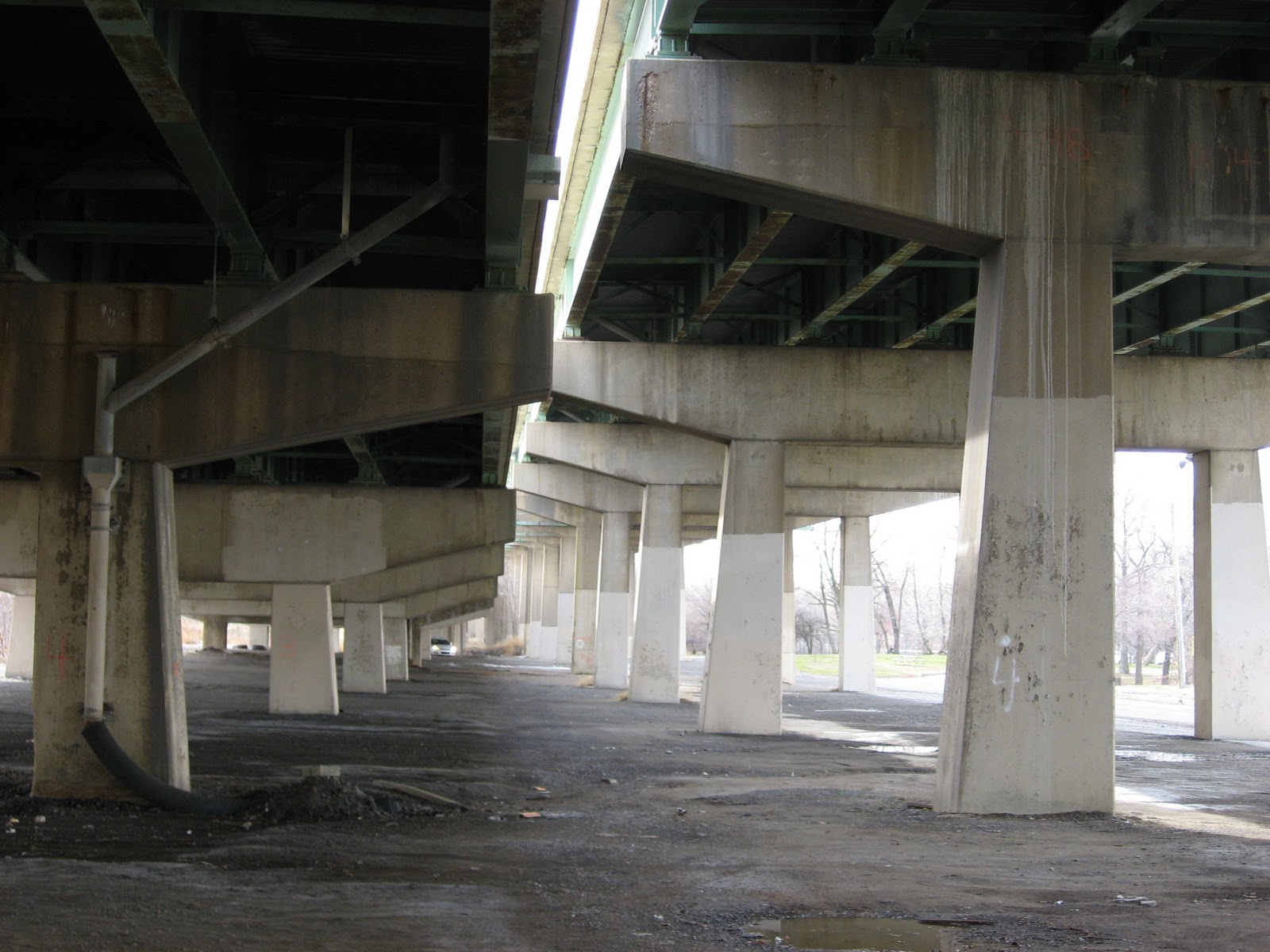

Additionally some the space underneath has
been re-appropriated on the east side of the park as a skate park, so it’s not totally
desolate.

So with this ride finished I
figured I’d buffer out the ride and show the amount of the city I’ve ridden
through on the past two rides. Here it
is:

Voila! Not that exciting yet – I know. However, I have biked through 2.64% of the
city so far.
I’ve been toying with the idea
of showing neighborhoods and maybe have cool infographics depicting the
neighborhoods I’ve been in, the percent of each, how many times I’ve been in
each, etc. I have run into a few issues,
mostly stemming from that the City of Philadelphia doesn’t have distinct
neighborhood boundaries. For example I’ve
found a shapefile that shows Center City divided into 2 neighborhoods (Center
City East and Center City West) and then I’ve found a shapefile that shows all
the neighborhoods you’d expect to find in Center City (i.e. Chinatown, Society
Hill, Logan Circle, etc.)
Additionally the neighborhoods
in the rest of the city sometimes have very different boundaries. Here is an
example of two Girard Estates boundaries.
Note the fact that one of the shapefiles does not even cover the entire
city.


I’m leaning towards the more
general neighborhood map (where Girard Estates is bigger and the file cover the
entire city). I’ll keep you all posted.
skateboarders doing something good for the city by re-appropriating space?!?!
ReplyDeleteHahaha - well I suppose I wouldn't say that should be a driving force for city development or design. They are a bit annoying skating around Love Park. As for FDR Park though it's cool they kinda retook the space under the freeway. The skate park looks almost organic. I wonder if PennDOT even knows it's there? I'd hope so. BTW, thanks for reading the blog.
ReplyDelete