Monday, May 9, 2011

Cross Section of Philly, via 5th Street (Lower North Philly edition)


In continuation of my 5th Street ride series this post is all about Lower North Philadelphia or, as known by many, “the area you don’t go” 


After emerging from the tunnel, bypassing much of Old City and more importantly tons of automobile dominated infrastructure, I found myself in Callowhill


Callowhill is an area, in short, that was built up as an industrial district in the late 19th century and continued to thrive as such until the mid 20th century.  It is now a collection of old industrial buildings (some vacant, some are cool loft apt/condos), mid-century office buildings and parking lots. Lots of parking lots.  There are several plans for the area, to redevelop some of the buildings for medium/high density loft style housing, reconnect the area to Chinatown and there is even talk of turning the abandoned Reading Terminal viaduct into a High Line-esk park.  Also, the area does have some spectacular views of the city’s skyline. 


The Callowhill district is not very wide and after about 5 blocks, I crossed over Spring Garden and entered Northern Liberties.  Northern Liberties is one of the oldest neighborhoods in the city. As mentioned in a previous blog post the neighborhood is home to the site when William Penn struck a treaty with Native Americans.  Much like the Callowhill district the area was home to several industrial complexes, mainly breweries such as Schmidt’s and Ortlieb’s, along with a large number of residences for industrial workers.  After many of the factories downsized and eventually shuttered the neighborhood went into disrepair and began a renaissance in the 1980s as an artist/bohemian community. As seen in many cities across the U.S. this low-rent, artistic community became a catalyst for new development in the area and the neighborhood is now better known for interesting architecture, innovative planning projects (i.e. Liberties Walk and the Piazza at Schmidt’s) and hipsters. Even the hipsters are beginning to be priced out. The neighborhood’s main commercial corridor is along 2nd street, but shops/restaurants and cafes can be found on the corners of many of the numbered streets.  After all that I don’t have many interesting shots of the neighborhood; I guess I’ll have to go back. 


The edge of Northern Liberties is Girard Avenue, a very wide, commercial corridor.  In 2005, SEPTA reinstated the trolley line that ran along Girard Avenue using historic 1947 PCC trolleys.  While planners typically advocate for fixed rail transit to help revitalize corridors, I’m not sure what the Girard trolley has done for the neighborhoods along it in the past 5 years. It seems more like a historical Disney ride than a functional transit line. The design of the stops and layout of the street does nothing to promote pedestrian safety and comfort along the 7 lane road.  The stops are not covered, and are essentially concrete steps in between moving traffic lanes. Additionally, the trolley runs only every 15 minutes during peak times and is not timed with either subway that it crosses, making it function more like a bus than anything else.  Sorry, that’s enough railing against Philadelphia transit for now, like much of SEPTA…they’re getting there. 


One the other side of Girard is the beginning of Old Kensington. To be fair there are a lot of different Kensingtons throughout Philadelphia’s Lower North/Northeast sections: Old Kensington, West Kensington, Upper Kensington, New Kensington…..  From what I can tell they are all fairly the same; historically industrial neighborhoods with vacant industrial lots, very underserved retail corridors and modest rowhouses.  I biked through two of the Kensingtons this ride: Old and West. 

Old Kensington is the industrial heart of the city; many of the factories located here were well known while Philadelphia was ticketed as the Workshop of the World.  I cycled past two relatively large industrial buildings that pretty much sum up the entire area, the vacant Drueding Brothers Leather Co. and the recently converted Sewing Factory Lofts. 

The Drueding Bro. was part of the area’s leather and tannery history and through what I can find closed in the 1960s, lying vacant ever since.  The buildings windows are completely broken out, the roof line looks so rusted that it is beginning to disintegrate, and some daring hoodlum (probably hipster) has sprayed the words Tape Radio across the middle floors of the building.  While researching this building I found this link that contains several photos inside the building and along the roof.  Pretty impressive. 


On the other hand, the Sewing Factory Lofts building is one of the courageous residential developments venturing far north of Northern Liberties.  The building contains 52 loft style apartments ranging from 1,400 to 2,200 square feet renting for $1,100 -$1,800.  While only slightly less expensive then comparable buildings nearer Center City, the building has lofts that are typically twice the size. I guess if you want a very large loft space, Kensington is the place for you. 


I suppose the price drop is because this is the scene right outside the building.


Many of the vacant lots across the neighborhood have either become defacto wildlife refuses or “temporary” homes of the homeless. Just to the west of this area is Ludlow and Temple’s main campus.  On my way back to the city I biked down 8th street which afforded me and amazing view of Septa’s regional rail station. 


The station is set up on the train line and the view is possible due to the fact that there is a large vacant lot on the east.  The City, Temple and other various organizations have been trying to lure a developer here for a while. The area has been designated as a TRID or Transit Revitalization Improvement District, a state designation that allows municipalities and transit agencies to work together and apply for state funds to plan and study the area.  More importantly a TRID allows for the creation of an organization that can capture additional tax revenue and pay for capital improvement in the area, similar to a BID or business Improvement District.   The Asociacíon Puertorriqueños en Marcha (APM) is leading the development of the lot for the past few years.  However despite the TRID, and having federal funds in place the team is still attempting to find financing for a 164 mixed-income apartment and retail development.

For more information please follow the links here, http://planphilly.com/nutter-breaks-ground-parkway-temple-projects and http://planphilly.com/node/3631.  I know that I didn’t get all that information. 

Nearby the train station I was totally caught off guard to see a row of houses that seem to be fairly well kept sitting in the middle of a green and deliberately planted block, so naturally I decided to explore.  Biking down Darien Street I discovered this horse and immediately thought it was some urban farm project.


However, the landscaping was too passive to be farming. Then I discovered a sign along the NTI looking fence.  It turns out that it’s some sort of pilot project for the Philadelphia Water Department and or the EPA.  I’m a little over researched right now form looking up the TRID development, but the while idea seems to be a really cool.  There are rolling swales and planted lawn/trees to minimize stormwater runoff.


That's about all I can blog about for now.  Stay tuned, I'm only HALF way up 5th Street.  

Week 9 in Review (May 2 - 8)


This week has been full of cycling adventures. I feel like it’s the first week that it has been warm enough to bike around without worrying about biking in the shorts or pants and being adversely affected by the wind. There are no wind chills when it’s 70. I also I have been slow to update my 5th Street ride series and I went on another epic bike ride with Zack this week. So therefore I’m just going combine my stats and everything into the week’s review and then dive into more detail when the time comes that I actually write about the ride. 


Routes
Miles
Minutes
Speed
Calories Burned
5
62.5
296
12.68
3,550

Aside from my ride through West Philadelphia with Zack I went on some pretty decent rides. Most notably on Tuesday, when it was 72 and sunny for the first time in a while I decided to traverse the busy Center City streets around city hall, bike up the parkway and do a gorgeous loop around Fairmount Park.  I saw a gaggle of baby geese that were just adorable but I didn’t have my camera so I couldn’t capture the moment. Then Yesterday I went on a lovely, yet hungover, ride with two of my friends, Meghan and Judd. We had discussed this ride earlier in the week and then attended a fairly epic Kentucky Derby party, where I learned that a Mint Julep is mostly Bourbon. However, we all made it to our meeting spot on the Schuylkill Trail and then biked to Manayunk for a coffee and bagels. It was the perfect day!


On Sundays the City closes down West River Dr./MLK Dr. for bicyclist and for runners alike.  Before noon one can travel from the Art Museum to the Falls Bridge, about 4.1 miles.  However, after noon they reopen the road south of Sweet Briar Lane to traffic, leaving about 2.7 mile car free.

All in all it was a great week for biking. Including my West Philly ride, I’ve made huge gains in in the percentage of Philly I’ve been through. This week I have cycled through just shy of 15% of the entire city, 14.85% or 21.3 sq. mi.  Additionally I’ve made great gains in the number of neighborhoods I’ve been in, 88 out of 138 neighborhoods or 64%.

CORRECTION: Last week I stated 89 neighborhoods but I miscalculated and there were only 80 neighborhoods that I have actually biked through more than 2.5% of them, which is my criterion for showing it on the map.  

A few key points concerning my current biking trends are: I’ve biked through nearly 85% of Center City, and I’m shy of only two neighborhoods in West Philadelphia before I can say I’ve biked through all of it.  Make sure you check out the Geographic Analysis page for a more in depth look.    


Thursday, May 5, 2011

Cross Section of Philly, via 5th Street (Center City edition)


In this installment of my 5th Street ride it’s about heart of Philadelphia, Center City.


The following map shows the three neighborhoods in this post and the bike route I took as a whole. Also the link for the dailymile route is right below. 


So my last post ended right before getting to the ever eccentric South Street and crossing over into Center City. 


Once over South Street I entered Society Hill, a very historic and bougie neighborhood. According to the Wikipedia page, the area is home to the largest concentration of 18th and 19th century ‘architecture’ of any place in the U.S.  It sounds like someone form the civic association added that tidbit in; however, it is a very charming and significant district, if not for its historic architecture but for the redevelopment of the neighborhood in the 1950s and 1960s.  Ed Bacon spearheaded a plan to preserve much of the older buildings and integrate modern architecture and amenities, to create an ideal urban neighborhood.  Within the neighborhood is a network of pedestrian pathways and pocket parks that provide formal and informal public spaces.  Also there are 18th and 19th century houses standing next to 20th century replicas, standing next to mid century modern townhouses.  I’ll admit is it’s one of the best areas to walk around the city.


Because of the immense success of Bacon’s redevelopment plan the area has been quite overrun by wealthy, older, white folks.  Sometimes you can catch snippets of conversations while wandering around the streets.  For example recently I was on a tour and at the Physick House, and as these ladies were setting up for their annual garden show the following was spilling from their mouths, we’ll call them Camilla and Martha:

Camilla: Oh you should come down the shore with us this summer

Martha: Well we can’t this summer, we gave up or shore house last year.  However, you’re more than welcome to come over to our heated pool and play bridge. 

Camilla: Oh that sounds lovely but I have never learned to play bridge.  The last time I tried to learn I just gave up.

Martha: Well you just have to hire a professional bridge trainer to teach you, it’s that simple. 

#firstworldproblems

Once I passed Locust St. I left charming residential Society Hill and ended up in, I’m not sure what the name of it is, I guess it’s technically Independence National Historic Park.  A cross between Society Hill, Washington Square and Old City, the National Park Service dominates 45 acres of urban space.  The area is home to several national landmarks including, The Constitution Center, the Liberty Bell, the Betsy Ross House, Ben Franklin’s House, and many others. However none are more important than Independence Hall situated on Chestnut between 5th and 6th Streets and the namesake for the entire area.  Sidenote: as an American and an urban designer I appreciate Independence Hall and the cobblestone paving choice along 5th and Chestnut Streets.  However, as an old beat up bike, Loretta doesn’t appreciate cobblestone. 

Independence Mall is a 3 block long parks that is anchored by Independence Hall to the south. The mall is also an Ed Bacon move, one that is not nearly as celebrated by local residents as Society Hill.  In the 1950s Bacon had the idea for a grand open space to celebrate the national landmark.  It turned out that clearing 3 full blocks of city proved real hard for the tiny Independence Hall to capture. The original plans of formal landscaping and symmetrical gardens were scrapped in the 1990s when the National Park Service created a plan to add several tourist related buildings in the mall (i.e. the Constitution Center, Independence Visitor Center and the Liberty Bell Pavilion).  Over the past 10 years the redesign of the mall has been under constructed and finished just last year, at a cost of $300 million.  Inga Saffron (resident philly.com architecture critic) has a good review of the effects of this process. 


The mall is additionally surrounded by several important federal buildings and museums such as the Federal Reserve Bank (Philadelphia), the U.S. Third Circuit Court along with these gems:

The Bourse – an old commodities exchange building that is now a food court and tourist shopping center


The new National Museum of American Jewish History - completed last year as one of the pieces of Independence Mall’s redevelopment.


And the U.S. Mint - just for you Mom.  My mom still laments the fact that when visiting Philadelphia back in the mid 1990s she was stuck holding cameras.  I‘ve assured her it’s not that exciting. 


Shortly after the U.S. Mint/Arch Street 5th Street becomes very wide and the bike lane and  a lane of traffic disappears into a tunnel, avoiding the Ben Franklin Bridge.  It’s super fun to ride down and shot ridiculous things.   


Tuesday, May 3, 2011

Cross Section of Philly, via 5th Street (South Philly edition)


As I stated before I had an idea for a bike ride during a trip I had taken to FDR Park earlier in the week.  On my way back to my new apartment I biked up a large portion of 7th Street and found it to be absolutely fascinating. It was kind of like a cross section of South Philadelphia. So I thought it’d be awesome to bike up the entire length of a numbered street to get a fuller perception of the city. 

Choosing a route was kind of difficult. While essentially there are 24 some-odd routes one can take through the city (approx how many numbered streets run through Center City) after some initial research there aren’t many continuous streets. There is the obvious one; Broad Street, but I have biked on that before and found it to be 1) too busy and 2) not a very good cross section of the city as far as neighborhoods. Many neighborhoods’ boundaries are on the edge of Broad Street and one side of the street can be completely different than the other.  Additionally, many of the numbered streets west of Broad end just north of Temple. That left east of Broad. There are several streets that are quasi-continuous.  7th is probably the longest because it goes through the Sports Complex.  Front and 3rd were also considered.  However I settled on 5th because it has some cool features: 1) a tunnel, 2) it’s a commercial corridor further north and 3) it does not get broken up by the Vine Street expressway, Roosevelt Blvd or the large railroad corridor (near Temple).  So 5th it was, below is a map of my route as well as the stats:


Miles
Minutes
Speed
Calories Burned
24.3
120
12.1
1,445

Also I made a reference map of all the neighborhoods I cycled through or bordered.  There were several neighborhoods I went through and part of the reason for making this map is for me to get my bearings as much as it is for you the reader.  Because there is a lot to write about I’m also just going to highlight the neighborhoods I am talking about in that post. 


The ride started off with me biking to what might be described as the grundle of civilization, the Comcast service center at Columbus and Reed.   This is where time goes to die, as one has to wait in line with people dropping off their Comcast equipment (i.e. me), or people that don’t understand the concept of a toll-free phone number.  These patrons get the same service from representatives that could care less if they are talking to humans or a flock of Canadian Geese.  Anyway, that happened and I continued south to my starting point at 5th and Oregon. 


The ride begins in a sea of parking lots and auto dominated businesses lining Oregon Ave.  But just a few blocks north lays Whitman, a neighborhood whose namesakes is the large, suspension bridge just south of the shopping along Oregon.  The blocks are typical of South Philly blocks; two story, simple rowhouses that have at least one of or more of the following three elements: awnings, vinyl siding somewhere on the house, or a picture window.


The area is also home to Mifflin Square, one of the few block sized squares found throughout South Philly, similar to Girard Park (in Girard Estates) or Dickinson Square just to the northeast of my route.  However this square is a little drabber then the others ones, the trees are not as large, the grass looks fairly untended, the sidewalk seem like it has seen better days.  There also is not much in it but a newer looking playground and an older looking basketball court.


Continuing up 5th Street I entered the neighborhood of Pennsport. Pennsport is somewhat hard to distinguish from Whitman, at least the part along 5th Street.  But it’s much more storied as it has been a residential area for the docks and industry that lay along the Delaware. The neighborhood is also home to 2 Street, a portion of 2nd Street that houses many of the Mummers’ clubhouses. While I was biking through Pennsport I made two discoveries. First, this animal hospital which I had to snap a picture for my riding buddy Zack


Second, I found an abandoned hospital, Mt. Sinai.  The hospital used to be part of what is now the defunct Graduate Health System.  The system, whose namesake hospital is at 18th and Lombard, was bought in the mid 1990s by Allegheny Health and promptly went bankrupt, forcing the abandonment of Mt. Sinai.  Although the hospital is 11 stories and takes up an entire city block it is very small.  When shuttered in 1998 it only had a capacity of 170 beds and 500 employees.  In comparison, Pennsylvania Hospital, a relatively small hospital, contains 515 beds and employs 2,700 people. After closing there were plans for to turn the hospital into a long-term care center, and most recently into condominiums.  Both of those never got off the ground.


Additionally, in Pennsport there are several abandoned lots right along 5th street, which is surprising for the amount of density that is contained in the area.  However some of them were intriguing, like the following which seems to have been turned into a park a few decades back and then forgotten. I also appreciated the sign next to this “park”


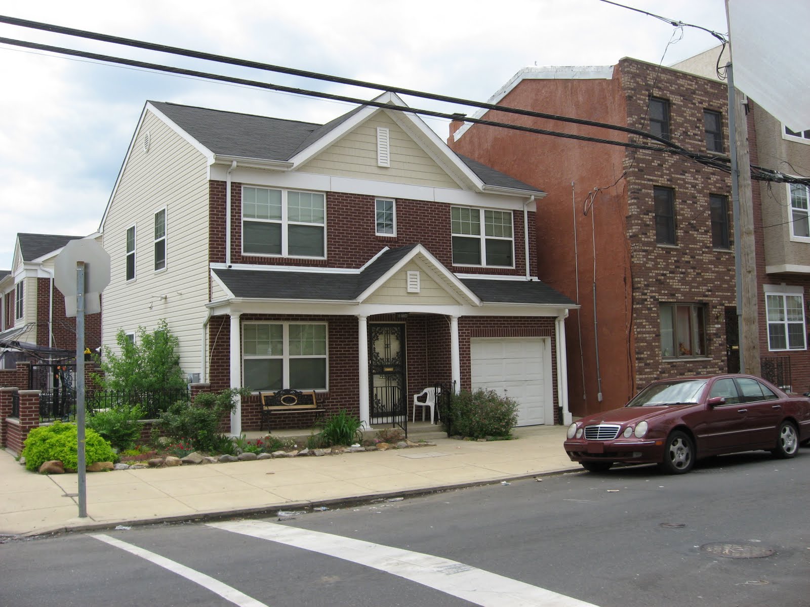
North of Mt. Sinai (or Reed Street) is an area that looks like it was redeveloped by the Philadelphia Housing Authority (PHA).  However I found no information to support this theory, in fact from the amount of for sale signs the houses seemed to have been developed privately.  Regardless, they are an utter shift from the Philly rowhouse typology. Constructed in what it looks like the mid-2000s, the houses are actually duplexes with a traditional suburban style porch, first floor brick, second floor vinyl façade and a lovely garage. 

Except this guy he is just straight up single family house.  The rowhouse next to him looks very confused about how his neighbor got there. 


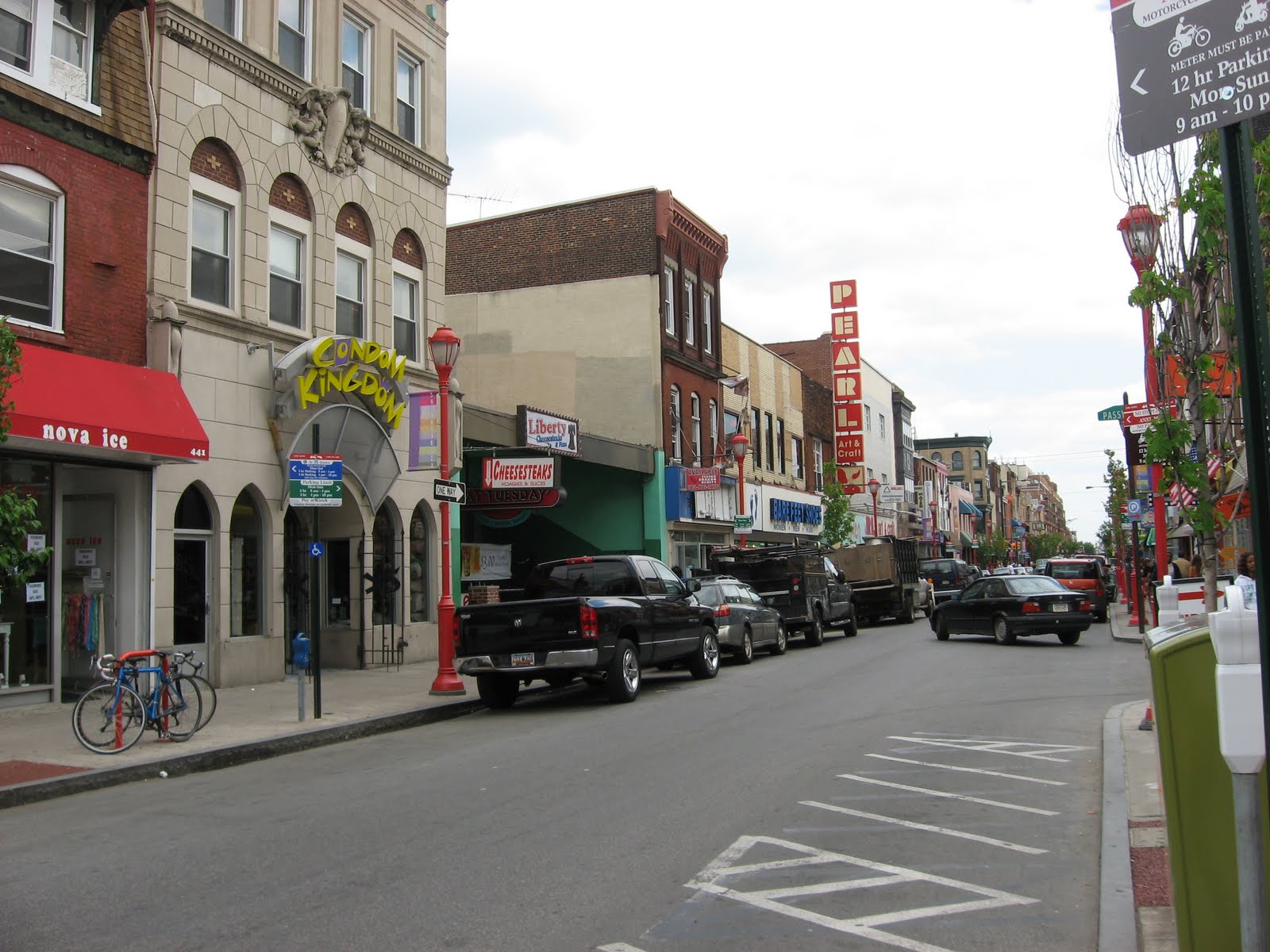
After crossing Washington Ave I entered Queen Village. This area lies just south of Center City and is one of the oldest areas in the entire city.  Once named Southwark, the neighborhood used to be home to a large number of Swedish immigrants during the colonial days of the city.  There is even a church on Columbus Blvd that is a reminder of the area’s Swedish heritage.  Today, the area is a mix of several different architectural styles dating from the 18th century trinity to the 21st century mega-rowhouse; a rowhouse that has a two-car garage, a Palladian window and possibly a balcony.  It’s like a Cherry Hill (New Jersey) “cottage” was stuffed between the Betsy Ross house and a typical Philly rowhouse.  Biking along 5th Street I passed what is actually PHA housing and then entered the adorable commercial center where 5th, Bainbridge/South, and Passyunk meet.  The intersection makes for some interesting urban form. 


I want to end this post by discussing some of the demographic observations I made while biking thorough this section of South Philly.  Along 5th Street in Whitman and Pennsport there is a diverse collection retail: Asian beauty parlors, Hispanic grocery shops and corner stores which look like they have been owned by the same Italian family since 1904.  After looking at the NY Times’ 2010 census map I realized that the area just west of 5th Street is extremely diverse.  There is even one census tract that is practically ¼ White, ¼ Black, ¼ Asian and ¼ Hispanic.  Also the two neighborhoods are quite possibly the densest area in the City of Philadelphia, approx. 45,000 – 50,000 people/sq. mi. Comparable to the densities surrounding Rittenhouse Square and in the Gayborhood.

Monday, May 2, 2011

Week 8 in Review (April 25 - May 1)


My week has ended up not as bike-tastic as I would have liked for how nice the weather is, but I suppose life kinda gets in the way of that sometimes.  However, I did bike a few places this week, including one trip around FDR Park.  This trip gave me the inspiration for a bike ride I took on Friday that I have yet to post (but will very shortly).  While on this ride I ended up biking from Pattison to Washington Square up 7th street and found that it was quite diverse.  After you get past the sports complex and into south Philly neighborhoods, the blocks tended to waver between being majority Hispanic and majority Asian, and then bam you hit Bella Vista and it’s White.  So taking this idea I decided to bike up the entire length of 5th Street, from Oregon to the northern border of the city, Cheltenham.  Stay tuned b/c there are lots of pictures and thoughts on the matter.  However below are the three miscellaneous rides I’ve taken:


Routes
Miles
Minutes
Speed
Calories Burned
3
22.5
99
13.61
1,178

I’m going to cheat and show the buffer map before I actually show the route map/blog post for my 5th Street ride.  However with this ride, I’ve biked through 12.83% of the city or if you do it by neighborhoods, 89 of Philly’s 138 neighborhoods,


I also updated the Geographic Analysis page